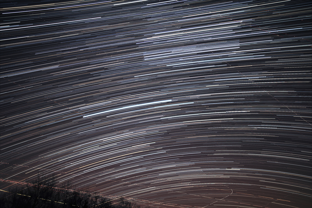
These star trails were obtained by taking a series of images over a period of 90 minutes with a stationary camera.
The area of sky here includes Orion, Canis Major, and other nearby constellations. Displaying the images in this way makes the different colors of the stars very obvious. (The dotted lines nears the bottom of the image are trails of airplanes.)
Rolling over the image will remove the star trails and show the individual stars and constellations.
The paths made by the stars as the Earth turns depend on their declination (their north-south location, analogous to latitude on Earth:
Stars below the celestial equator (like Sirius) have paths that curve downward.
Stars above the celestial equator (like Gomeisa in the upper left) have paths that curve upward.
Stars on the celestial equator (like Mintaka in the belt of Orion) have perfectly straight paths across the sky.